Showing posts with label Morrison Bridge. Show all posts

Monday, 6 October 2014

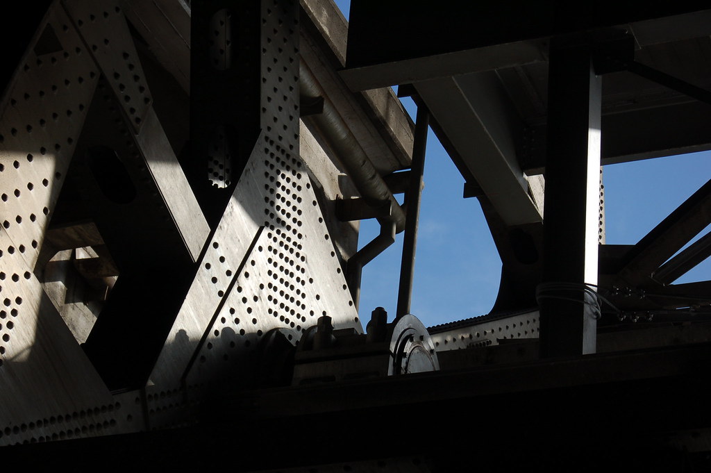
The blue sky seen from deep inside the leg of the Morrison Bridge while on the bridge walk, October 25, 2008


DSC_434

Here's what I mentioned on yesterday's post, the view as the bridge operator raised the bridge while we were down inside the western support. The towers are on the south side of the bridge, and we entered through the bridge operator's door.

Here's some info on the bridge that I found on the world wide web:

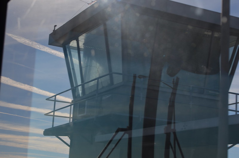
The bridge is the largest mechanical device in Oregon. Thirty-six feet gears drive 940-ton counterweights located inside each of the piers. The 69 ft. clearance is sufficient for most river traffic, requiring bridge openings only about 30 times a month. It currently carries 50,000 vehicles daily in six lanes. The canted windows of the control tower give the distinctive look of air traffic control towers. It is named after John L. Morrison, a Scottish immigrant who built the first home on Morrison Street. The current bridge does not connect to Morrison Street at its west end because the second bridge was left in operation while the latest version was built.
Sunday, 5 October 2014

I'm not gonna let vacation slow me down, y'all.


DSC_0890

I'm posting this photo today in honor of my departure from Portland's international airport, known as PDX. I'm off to England and Scotland for a Trafalgar tour, a dream trip with my friend Juliet who moved to Portland from Minneapolis. She found me through this blog! So cool!

Don't be fooled, though. This is not the air traffic control tower seen from the airplane. I took this photo on October 5, 2013, from a TriMet bus window as we crossed the Morrison Bridge. The bridge operator works in there and raises the bridge as necessitated by Willamette River traffic. I've actually been on a tour of that bridge and got to go down into the support, which I call the leg, of the bridge through the door on the tower. After we walked down the stairs, the bridge operator raised the bridge and we got to hear and see all of the works move--Spielberg woulda loved that sound!--as well as a huge concrete section which eventually opened enough that we could see the sky!

Tuesday, 4 March 2014

While cold and blustery weather lingers, I'm dreaming and knowing this too will come, No. 5

I took this photo at 6:43 p.m. on June 14 2008, as I walked across the Morrison Bridge towards Southeast Portland. Look at that blue sky! I hope that I can remember to take a similar photo this year, just to document any changes in the buildings. And I hope that the sky is just as blue! Can you see the people walking on the Eastbank Esplanade? They know how to enjoy the Willamette River's east bank. When I got there, I walked down that spiral ramp and along the esplanade until I came to the Hawthorne Bridge. Then I walked across it and began my homeward bus rides, taking a couple of them to get home. I lived in Northwest Portland then, in the Alphabet District. My little Mama and our miniature dachshund Duncan were still alive then, and we totally enjoyed our lives in Portland. We'd been here two years, almost to the day.

P.S. I work in the brick building with the flags on top. When I take photos from the rooftop garden, I'm on that lower part of the building, very near those windows, the ones half visible due to the angle of the photo.


There's a nice patio there, a neat place to go outside at break or at lunch, to enjoy whatever the weather has to offer. Here it is after a rain had marked the edges of the tiles. I took this photo on August 23, 2013, at 7:13 a.m.

Wednesday, 13 February 2013

A shared mass transit stop on SE MLK

Click here for a trip to City Daily Photo, transporting you around the world every day.

DSC_0260_crp_rz


January 26 after the lecture at the Architectural Heritage Center, I decided to ride the Portland Streetcar down to the Oregon Rail Heritage Center to visit the steam locomotives. As you can see from this photo, the streetcar and the TriMet bus share this stop. That's the Morrison Bridge westbound approach you see there above the streetcar.


DSC_0259_crp_rz

I waited while this lady boarded the bus. I think it's fantastic how that little ramp automatically folds out of the bus floor once the driver activates it. Once the bus drove off, the streetcar moved into place beside the yellow strip of ADA truncated domes which serve as a detectable safety zone, a system of textured ground surface indicators which assist blind and vision impaired pedestrians. Personally, I find them helpful, too, especially when it's been raining. I feel like they're less slick than a wet sidewalk. Anyway, the doors on the streetcar slid open and I walked on, took a seat and looked out the huge windows as we continued southward are MLK, going underneath the eastbound exit ramp of the Morrison Bridge. I love mass transit!