Showing posts with label Big Pink. Show all posts

Sunday, 13 April 2014

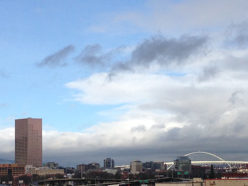
Fremont Bridge

IMG_2180

On a rare bright sunshine day in March I happened to be on the rooftop garden at work for my morning break. When I walked out and saw the sunshine lighting up the Fremont Bridge, I immediately took this photo with my iPhone 5. I cannot remember ever seeing this, and I've worked in that building since June, 2006. Not that I'm on the rooftop garden every single work day, but you'd think I would have seen it at least one other time in all of those years.

Friday, 21 March 2014

See what prompted me to get off the 20 bus on East Burnside last Saturday


An enclosed tricycle. What do you think of it? While I think it is so cute, I myself cannot imagine being out in regular traffic in it--even with bike lanes--mainly because I cannot imagine riding a bicycle or a tricycle in traffic, period. Someone parked it here, beside the bike rack--that blue bar--so someone rode in it.


Once I walked across East Burnside onto NE 16th, I stopped to take this photo. Now I see that the enclosed trike is in between two bike racks; I wonder why it is not locked to one of them? Hmmm. Look ahead on the sidewalk and you'll see a bicycle waiting for its rider. I wonder if it is locked to a bike rack? Oh, one more thing to notice in this photo that I took in Northeast Portland. Beyond the green street sign and the yellow one with the arrow on it, see what looks like a tall building? That is the Big Pink which is on the west side of the Willamette, a mile and three tenths away! So cool to find the unexpected in a photograph!


Closer view of the back of the trike. It's an interesting piece of machinery.


Wednesday, 16 October 2013

Director Park, downtown Portland, blue sky and clouds


Click here for a trip to City Daily Photo, transporting you around the world every day.

DSC_0029_PM

October 8, 2011, a Saturday. Walking around Director Park, I looked up at the glass canopy and decided to take this photograph. I liked how the blue sky and clouds looked beyond the various buildings north of the park. Especially pleasing to me is the Big Pink peeking at me over towards the right edge of the photo. I'm standing at a diagonal from it, near the corner of SW Yamhill Street and SW 9th Avenue.  Click here for  Director Park Commonly Asked Questions. Gosh, I like that phrase a whole lot more than FAQ.

Monday, 14 October 2013

The short-lived snag

Click here for a trip to City Daily Photo, transporting you around the world every day.

I know I promised this on Sunday, but I didn't feel very well all day--felt a chill, didn't even make it to my Northwest Film Center's Reel Music Festival documentary, THIS AIN’T NO MOUSE MUSIC!

DSC_0909_PM

I walked to the corner of SE Grand Avenue and East Burnside. When I stopped at the bus shelter, I immediately noticed that the Burnside Bridge was up. The snag. I'm on the east side of the Willamette, waiting for an eastbound bus which is coming from the other side of the Willamette River. I took this photo at 3:02 p.m. By 3:07, the bridge was closed and traffic appeared in the eastbound lanes. Naturally, I don't know the entire length of time that the bridge was open, just the span of time from when I saw it completely open until it was completely shut--I'd say five minutes is a short snag when something that huge is involved! Soon the bus came and I rode home. In another example a serendipitous positioning of structures in a photo, look at the line up here--the Big Pink, the Burnside Bridge's Italian Renaissance tower where sometimes there is an operator inside, and the open bridge structure. I'm a huge fan of serendipity!

I'll never forget the first time that I drove west on Burnside back when we lived in Northwest Portland. I was headed across the river, can't remember why now, but as I got closer to the bridge, my mind filled with confusion as I realized cars were stopped in front of me. Then I saw a big shape on the horizon and thought, "They're moving a house across the bridge. Nope! That's the bridge! It's up!" My first time ever to approach an open bridge in Portland. What a treat!

Here's information from the Multnomah County Web site about the Burnside Bridge:

One of four Willamette River crossings built in Portland during the "Roaring Twenties," the Burnside Bridge stands in age right behind the County's Hawthorne and Broadway bridges.

This 1926 structure is located on one of the longest and busiest streets in the Portland area. The five-lane Burnside is a direct connection between downtown Portland, Beaverton to the west and Gresham to the east. Last year, about 40,000 vehicles a day used it. So did more than 1,000 pedestrians and bicyclists each day.

In addition to its important daily work load, Burnside plays a key role during emergencies. Burnside Street and bridge are designated as an official emergency transportation route. The bridge, as part of this "lifeline corridor," is the one non-freeway river crossing which emergency vehicles and suppliers are asked to use.

Burnside's artistic side

The three-span Burnside is a historically significant structure. It is the only Willamette River bridge in Portland designed with the help of an architect, a result of the early 20th century City Beautiful Movement that called for adding architectural ornamentation to engineering designs. The bridge's distinctive Italian Renaissance towers reflect the trend. Burnside is eligible for the National Register of Historic Places and protected by preservation laws. Originally designed by the firm of Hedrick and Kremers, Burnside was completed by Gustav Lindenthal (1850-1935). Burnside's opening mechanism, or bascule, was designed by Joseph Strauss (1870-1938), whose Golden Gate suspension bridge would open 11 years after Burnside.

The Burnside Bridge main river structure consists of two 268-foot side span steel deck truss side spans and a 252-foot double-leaf Strauss trunnion bascule draw span. The bridge originally had six lanes of traffic, but in 1995 the City of Portland requested that bike lanes be added to the bridge, so one lane of traffic was converted into two bike lanes. There are sidewalks on both sides of the bridge. The overall width of the structure is 86 feet. Vertical clearance of the closed bascule span is adequate for the majority of river traffic, with openings necessary only about 40 times per month.

Only minor modifications have been made to the bridge since its construction. Electric street car rails were removed in the late 1940’s, lighting and traffic control devices were updated in the late 1950’s, automobile traffic gates were installed in 1971 and the bascule pier fenders were replaced in 1983. Several deck resurfacing projects and expansion joint repairs have also taken place.

The east approach to the bridge is approximately 849 feet long and has two distinct types of construction. The first eight spans consist of steel plate girder spans ranging from 75 feet to 106 feet in length. The steel girders and steel interior floor beams are completely encased in concrete. A concrete deck spans the floorbeams. The next seven spans are composed of concrete stringers spanning continuously over concrete columns and floorbeams. Six of these spans are 22 feet long and one is 40 feet long.

The west approach is approximately 604 feet long and consists of 19 reinforced concrete spans ranging in length from 22 feet to 62 feet. The first 13 spans average 22 feet and consist of reinforced concrete stringers acting continuously over concrete columns and floorbeams. The next three spans average 40 feet in length and are of similar construction. The last four spans are 62 feet long and consist of four main simple span concrete girders that carry interior concrete floor beams and stringers. A concrete deck is cast with the girders, stringers and floorbeams.

And a bit about a bascule bridge:

Bascule bridges have sections that rotate upward and away from the centerline of the river, providing clear passage for river traffic. Side-by-side on the Willamette River in downtown Portland, the Morrison and Burnside Bridges are two examples of bascule bridges. These two bascule type bridges have a very clean, uncluttered look to them because the counterweights and operating machinery are located out of sight in the piers supporting the bridge. The Morrison Bridge is a Chicago-type bascule bridge, and the Burnside Bridge is a Strauss-type bascule bridge.
Saturday, 12 October 2013

Fall foliage and the Big Pink--can't get much better on a blue sky Saturday

Click here for a trip to City Daily Photo, transporting you around the world every day.

DSC_0906_PM

Last Saturday after my volunteer work at the Architectural Heritage Center was done, I walked north on SE Grand from SE Alder to East Burnside. My intention, to catch the next 12 or 19 bus home, struck a short-lived snag, but on the way I got to take this fall foliage, Big Pink, colorful Central Eastside Industrial District photo. Crossing SE Ash, I noticed that if I stood in just the right spot, I could make it seem that the Big Pink came up out of the corner of that vintage building painted a pale butter yellow. (I read something recently about plans to tear down the pale butter yellow building and put up some sort of taller building. I am not happy about that. I hope it doesn't happen.) Anyway, I check the traffic signals and the traffic, then stood in the street and took myself this photo. Success! By the way, the Big Pink is on the west side of the Willamette River, and I'm over on the east side taking this photo, almost a mile away! Come back Sunday for a photo or two of the short-lived snag.

Wednesday, 10 April 2013

April 10, the movement of pigeons and automobiles. Where have they gone?

Click here for a trip to City Daily Photo, transporting you around the world every day.

DSC_0360_PM_alt

On January 26, 2013, I noticed the pigeons once again swirling above the intersection of NE MLK and East Burnside, at the west end of the used car lot. I've seen them off and on since I moved to Northeast Portland in January, 2011, flying in all directions at this intersection, sitting on the wires between utility poles and on the billboard above the mid-century roof of the used car lot. Once I had seen the pigeons being fed by a man as I stood at the bus/streetcar stop just a few steps to the right, out of this photo. On this particular day, I happened to discover that the man feeding them came out of the office at this used car lot. See several photos on this topic, below.
  DSC_0237_BF_fill_light.jpg_PM_rsz

The evening of March 23, on my way home after the members' party at the Oregon Rail Heritage Center which is south of here, imagine my surprise when I saw this sight  from the bus shelter on East Burnside. No used cars beneath the roof, just a few left at the back edge of the lot, far from the street. When had someone moved the cars? Why? A quick Google revealed no online evidence of going out of business connected with this business. A mystery.
  DSC_0207_PM_alt

Here's a photo that I took on March 29, trying to capture the vast emptiness of the lot. I like that the Big Pink towers in the background, several blocks past the other end of the Burnside Bridge, less than a mile from where I stood to take this photo.

DSC_0347

Back to the pigeons and their movement. The original billboard, pigeons perched, taken on January 26. 
  DSC_0348_PM_alt

The pigeons take flight because the man who feeds them has come out of the office and is walking west, to feed them across MLK, just south of the bus/streetcar shelter where I had seen once while I waited to transfer from one bus to the other. Can you see him? He's towards the bottom left corner of this closely cropped photo, smack dab between two poles. 

DSC_0353_PM_alt

Once he's tossed all of the bird food onto the sidewalk, the man crosses the street and goes back to the office. The pigeons ignore his movement, way more interested in eating  than in following him. I suppose the actions of these pigeons prove that they are capable of learning. 
  DSC_0213

The original billboard, minus the pigeons along its top edge--they're over to the right on the utility wires. I bet they're wondering what's happened to the man who used to come out of that yellow structure with the blue roof, carrying an orange bucket of bird food for them. 

DSC_0029

Another surprise. The new billboard, photographed on April 2. One pigeon perched.

Monday, 7 January 2013

Seen from the Portland Streetcar

Click here for a trip to City Daily Photo, transporting you around the world every day.
DSC_0068

Since the streetcar has a dedicated lane for its tracks right beside the sidewalk, taking photos through its windows can result in some good shots, unless the reflection overpowers what you're trying to photograph. Luck was with me when I took this photo on Saturday, September 29, 2012, while riding east over the Broadway Bridge on the Portland Streetcar's Central Line. 

Notice the bicyclist in the lower left? Many Portlanders commute across Portland's bridges, the ones which have bicycle lanes and/or sidewalks and are open to more than vehicles. Lots of folks ride on the weekends, too. And don't think they only ride in blue sky weather. Nope. I see them riding in the rainy, cold days throughout winter.

For me, a highlight of this photo is the 1896 Union Station and its recently renovated roof--an article in The Oregonian identified the work as an upgrade, pointing out that it was the first one since the 1930s and that it was needed because of the roof's condition which meant that buckets could be found here and there inside the station, filling up with dripping rain. 

The Big Pink, the tall building to the right of center, stands within walking distance of the railroad station--seven blocks--or a short ride on the MAX Yellow Line which is the MAX line that I take from downtown to the Portland Trail Blazer home NBA basketball games at the Rose Garden Arena--the MAX Yellow Line crosses the Willamette River on the Steel Bridge which is south of the Broadway Bridge and just out of sight to the left of this photo.

The curving street is NW Broadway, until it crosses West Burnside at about the vanishing point of the pavement in this photo, then it becomes SW Broadway. Burnside divides Portland into north and south, while the Willamette divides it into east and west. 

On the right edge of the photo, the building you see a portion of is the main US Post Office for Portland.